Live
Exhibition Radar
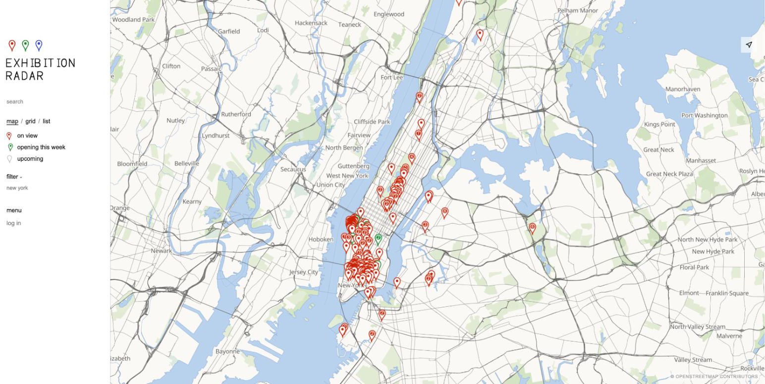
A map and public calendar of museum and gallery exhibitions, updated daily.
In brief
- The question
- How do you keep one accurate, current calendar of exhibitions when every museum and gallery publishes its shows in a different format?
- The approach
- One scraper per venue feeding a shared pipeline, with publication checks that hold doubtful records for review, shown on a map-first site.
- The result
- Live at exhibitionradar.com and refreshed daily. Fetching sources in parallel replaced a one-at-a-time run that took about an hour, and the time for a phone to show its first map pins fell from 7.3 to 4.5 seconds.
The idea
Exhibition Radar lists current art exhibitions at museums and commercial galleries, searchable and filterable by city, artist or venue. The differentiator is that it is easy to load and easy to use.
The mission is a way into art for everyone: people already in the scene who want to know what is on this week, visitors to a new city, and people who have never stepped into a gallery.
How a run works
- Venue websites
- Scrapers
- Publication checks
- Geocoding
- Postgres
- Map and calendar
How the data gets in
- More than a thousand source scrapers, one file per gallery or museum, sharing a single HTTP client and a set of date and address helpers.
- A daily GitHub Actions run fetches 32 sources at a time, each in its own process, and four writers save what they return to Postgres.
- Polite by design: one request per host at a time, 1.5 seconds apart or the site's own robots.txt crawl delay, with an honest bot User-Agent.
- Venues are geocoded once, at write time, from the venue's own site where possible and from OpenStreetMap's Nominatim otherwise.
Working with messy data
- Publication checks are conservative. A record with a missing title, a filename for a title, an invalid source link, a missing venue or reversed dates goes to review, not to the site.
- Public submissions land in a separate pending table and reach the live listings only after approval in the admin.
- The image shown for each exhibition is picked and measured as part of the daily run.
Decisions and why
- The front end is plain HTML, CSS and JavaScript with no framework and no build step, because the point of the site is that it loads fast.
- The map is the landing view on desktop and phone: MapLibre GL over OpenFreeMap vector tiles, with a hand-written sketch style.
- Geocoding happens when a venue is saved, not on every page load.
- Scrapers write straight to the database with no person in the loop, so the checks have to be strict. Anything from the public goes through approval instead.